
Fort George: Sink hole at 18th-century Scottish fort putting sea wall at risk of 'catastrophic collapse'

The damage is the result of coastal erosion on the Moray Firth
A sea wall at a large 18th-century fortress in the Scottish Highlands is at risk of "catastrophic collapse” due to a sink hole.
As reported by the BBC, the sink hole at the historic Fort George on the Moray Firth was revealed in a planning application for emergency works submitted by Historic Environment Scotland (HES) to Highland Council.
The application stated: “Without immediate intervention, there is a significant risk of catastrophic collapse of the sea wall and considerable loss of historic fabric.”
It said a sink hole had opened in the ground behind a section of the sea wall to the north-east of the fort, known as the North Glacis.
The Category A Listed Building was constructed following the 1745-46 Jacobite rising and is described as “the finest example of 18th-century military engineering” in Britain. It is said to be among the best preserved of any major fortress across the country.
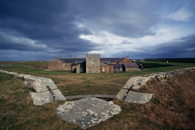

Nowadays, it serves as a base for the Black Watch.
The proposed repairs involve filling the hole with concrete to stabilise the wall, as beach levels in the area continue to drop due to coastal erosion.
A spokesperson for HES said: “In line with other parts of Scotland, coastal erosion and lowering of beach levels is affecting the Moray Firth.
“This previously caused localised scouring (the erosion of soil) in the vicinity of the Place of Arms at Fort George, commonly known as the Dog Cemetery.
“Concrete underpinning works took place in late 2024 which allowed for our Stonemasons and Labourers to safely carry out localised repairs to the existing stone wall and associated landscaping.”
“A further area of localised scouring at the North Glacis sea wall has since been identified and a small area of the North Glacis has been fenced off and is being regularly monitored, whilst public access to Fort George remains unaffected.
“Remedial works are planned and full access will be reinstated on the North Glacis once these have been completed.”
It said it will continue to monitor erosion at Fort George and other coastal sites.
A report accompanying the planning application said the cultural significance of the sea wall was largely down to its survival as a unified boundary around the fort. It said the planned works represented the "minimum necessary” to support the wall and reduce risk of collapse.
In the 18th century, the boundary walls housed accommodation for a 1,600-strong infantry garrison and a weapons store for 2,672 gunpowder barrels. They also housed a brew house and a chapel.
While the barracks are still in use, much of the site is open to the public as a visitor attraction managed by HES.
Earlier this year, three major projects were completed by Moray Council to tackle the issue of coastal erosion in the area.
These included a 50cm shingle bank built in Kingston, between Lein Car Park on the west side of the village, and the main shingle ridge at the lagoon on the east side.
Large boulders known as rock armour were also placed on Findhorn Road following significant erosion last year.
Chair of the Economic Development and Infrastructure Services Committee, Councillor Marc Macrae, said at the time the measures would ensure “long term protection” for coastal communities, and said the council was continuing to respond to challenges brought by erosion.
Comments
Want to join the conversation? Please or to comment on this article.